The Best of Colorado, Utah and Arizona
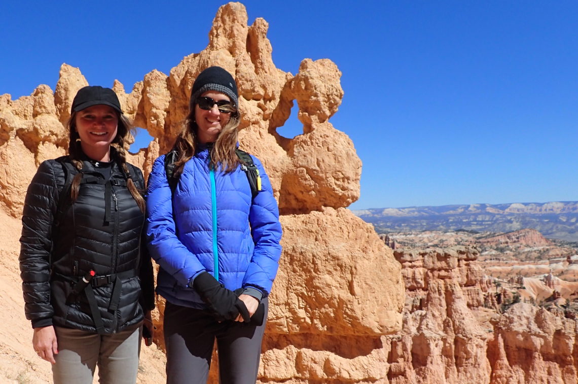
For this stretch of the trip, my childhood friend, Kelly, accompanied us. Kelly and I met in Kindergarten, when (as Kelly vividly remembers and I do not) I sat next to her on the first day. We were fast friends and remained so for 42 years. We started our friendship as children and continued it through our school years. We attended each other’s weddings and then 25 years later, I celebrated with Kelly and Bill at their 25th wedding anniversary dinner.
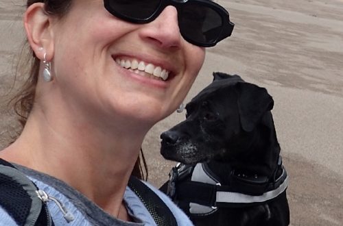
In the early stages of planning this trip, I told Kelly of my road trip dream. She instantly wanted to join me for a portion. We planned for Kelly to arrive in Denver, Colorado and leave from Flagstaff, Arizona. Abby was ecstatic to include a friend, and so was I.
Great Sand Dunes National Park is our first stop and is amazing and unique. Having acres of sand dunes rise out of the plains is awe-inspiring. You can go sandboarding (snowboarding on the sand), sledding on the sand, and hike until your heart is full. This national park is dog-friendly. So, Abby was allowed to hike the dunes with us. Kelly, Abby, and I trudged through the sand, quads burning. We headed to the highest peak we could find. The views at the top were unparalleled, a cross between desert and moon scape.
Half of the park experience is after dark! With a combination of dry air, no light pollution, and high elevation, Great Sand Dunes National Park and Preserve is an excellent and easily accessible dark sky viewing location. Night at Great Sand Dunes includes dunes exploration under a bright full moon, viewing thousands of stars on a clear moonless night, listening for owls along the foothills, or viewing migrating amphibians. Unfortunately, our weather brought rainy skies.
When I was experiencing the dispensary in Colorado, I bought 2 chocolate bars recommended by the staff for first time edible users. Soon after I picked Kelly up at the airport, I inform her that we are carrying some marijuana in the form of a candy bar, just in case we get stopped and I need to tell the cop. I tell her that I want to experience edibles and that she shouldn’t feel pressure to join me. I want her to be comfortable. She laughs and quickly agrees to participate.
The budtender told me to try no more than one square at a time. At 7pm on the first night, after safely unpacked and settled, Kelly and I each try a square. By bedtime, we are not feeling any different.
On the second night, bedded down at our next destination, Kelly and I each double it and try 2 squares. Again, we don’t feel any different by the time we go to bed.
At this point, we each agree that we must be immune to THC, the active ingredient in marijuana. The candy is having no effect and we’re disappointed that we haven’t experienced the calm, floaty feeling everyone describes. (What was really happening is that the effects were occurring while we slept.)
When we first arrive at Valley View Hot Springs, which is a clothing-optional nature experience, around noon, Kelly feels a bit unnerved by the naked people. I have more experience observing and participating in clothing-optional activities, but I definitely don’t want to be naked in the presence of my lifelong girlfriend. We remain clothed in our bathing suits. Other nudists look at us with odd, but “to each their own” glances.
Kelly thinks that maybe some more of the chocolate bar might relax her. I pull what’s left of the first bar out of my bag. There are 8 squares left. We decide that since we have had no effect from what we have tried so far, we will split what is left – 4 squares each.
Kelly and I explore the hot springs. We hike throughout the network of natural springs, stopping to soak in some pools. They are lined with rocks and sand, and the bottom is usually visible. We take lots of pictures. We check out the cement-bottomed, blue-painted, spring-fed pool and decide the natural ones are more appealing.
We find and settle into the largest of the natural springs. This spring water is chest high when I stand up. It’s an oblong circle, with the long end measuring 30 feet and the short end measuring 15 feet. It seems to be about 100 degrees and very comfortable. We make friends here. Someone asks what is clipped to my bathing suit. I explain about my insulin pump. This seems to answer the question of why we have our suits on, although I don’t understand the connection. Many people chime in about people they know with diabetes.
We befriend a lovely couple who sold all of their possessions in NYC, bought a little red RV, and took off to see the world. We exchange Instagram handles. They tell us about most of the sites we have left to see. They give advice from their months on the road. Kelly and I are feeling calm, happy, and slightly drowsy from what we believe is the warmth of the pool and the bonding camaraderie.
We leave the hot springs later than we expect, about 7pm. Kelly takes the first shift of driving. At the end of the 2 mile winding gravel driveway leaving the hot springs, Kelly says, “I am not feeling right. I can’t drive. The road is curving in weird ways.” I say, “Hmmm, well I feel fine, I’ll drive.”
We both get out of the car, walk around to the opposite sides, and plop into the other’s seat. Kelly immediately falls asleep.
I start driving, and choose an old favorite album to keep me awake. We have about 3 hours to Aspen, our next Airbnb reservation. Within 10 minutes, I understand what Kelly meant when she said the road was curving in weird ways. I could use extreme focus and make the road stay still, but if I drifted from concentration, the road started swaying and dancing from side to side. I convince myself that I can make it the 3 hours using sheer determination. My brain couldn’t see another option. I realize it must be the edibles.
I gather my gumption and focus my concentration, and slow to a speed that feels comfortable to me. I don’t know how fast I was going, but my guess is 35mph on a road with a speed limit of 55mph. Drivers were passing me and beeping. I was confused about what the problem was.
The GPS is still calmly telling me where to turn, unaware that it was directing an impaired driver. I follow like a lemming. Until I see a lighted yellow sign glowing in the dark ahead of me. It warns of treacherous switchbacks ahead. This sinks through my haze. I pull over to the side of the road and try to think. I know I can’t maneuver switchbacks in my state. But my reserved house is on the other side of the mountain range. I decide I need to find a safe place for us to stop for the night.
Using Google Maps, I try to find a hotel nearby. I am looking at the screen. I see the roads, markers, and directions, but I make no sense of them. My brain can’t decipher how this map translates to my driving the car. I try to wake Kelly. I say, “I can’t figure out how to program the GPS to get us to safety!” She mumbles, “Here is fine, go to sleep.” I say frantically to the back of her head, “Don’t you know that this is how people die in the Rockies? What if it snows?” She ignores me, already comatose again.
We are parked on the side of the road on a steep incline, headed (unknowingly) to Independence Pass. This infamous road to Aspen is not for those who fear heights. The Pass travels through 32 miles of mountainous terrain. The summit of the Pass reaches an elevation of 12,095 feet. Not only is it the highest paved lane in Colorado, it’s also full of steep drop-offs with only a few guard rails, tight curves, and narrow stretches that fit only one car at a time. For these reasons, the Colorado Department of Transportation closes this route each winter.
I decipher that there is a campground not too far from where we are. I click on the icon so the GPS will change the directions to take us there. For another slow, meticulous 30 minutes, I drive like an elderly lady. My hands are at 10 and 2, and my chin is directly over the top of the wheel, forcing attention. With relief, I pull into the driveway of the campground, slow to a stop, and realize that it’s abandoned. Happy for a place with a parking lot, but unsettled by its desertion, I try to reprogram the GPS to somewhere more populated.
I find a Rodeway Inn about 30 miles away. With a deep breath, I turn back onto the road. I repeat a mantra during this drive. “Find safety, find safety.” While it seems melodramatic, it kept me focused on the road and my path. When I finally spot the Rodeway Inn sign, I feel an overwhelming relief.
I leave Abby in the car with a snoring Kelly and approach the hotel. It is 11 pm, but it feels like 3 am. There is a 20-something man at the front desk. In my drugged state, I think that if I try to charm him, he will let us have a room, even with Abby. I lean seductively on the counter, trying to steady myself and to appear sober. I bat my eyes and say, “Do you have an available room?” He nods. I say, “We have a dog with us.” He shakes his head no, unimpressed by my flirting. I say with a slight pout laced with a guilt trip, “Well, can we sleep in your parking lot then?” He says, “That’s fine.”
I return to the driver’s seat and try to wake Kelly again, concerned that she needs medical help. She stirs, mumbles something undecipherable, and goes back to sleep. I decide she must be fine and, knowing that I can’t drive another second, recline my seat and get comfortable. Abby loves sleeping in the car. She snuggles down between our reclined seats, happy to have us within a paw’s reach.
It’s now 35 degrees outside. Luckily, with the Prius, it’s easy to leave the car running for heat. The car only turns on when necessary, but keeps us toasty all night.
In the morning, being many hours behind schedule, a few hundred miles off course, hung over, and exhausted, we decide to skip Independence Pass, Aspen, and Arches National Park. We go straight to Mesa Verde.
Mesa Verde National Park is spectacular! As you approach, you see the mesa rising in the distance. If you picture a volcano that pushed a toothpaste-shaped portion of land out of its caldera, you have a mesa. Switchbacks take you to the top of the mesa. The park contains 5000 archeological sites with 600 cliff dwellings. It is interestingly inverse-you are based on the top of the mesa, and the attractions are on the cliff sides down below.
The next morning, we tour one of the best preserved homes, named Balcony House. This was home to the cliff-dwelling ancestral Pueblo people for 700 years. Archaeologists believe this home dates back to around 1180 AD. It has 40 rooms, two kivas, and is considered a medium-sized cliff dwelling.
A kiva is a round room built below the floor surface. It is used for religious ceremonies, political gatherings, and celebrations. There is a small hole in the floor in the center of the circle. This served as the symbolic place of the origin of the tribe. Colorful murals depict sacred figures or scenes from daily life decorate the walls. A bench is built into the perimeter. Usually, only men are allowed inside.
The first part of the tour is easy, a descent of 100 feet down a walkway and staircase. To enter Balcony House, we climb up a 32-foot ladder. During the tour, we crawl through an 18” round tunnel. To get back to where we started, two more sets of ladders and stone steps span another 60 feet. This all happens on the edge of a cliff, at 7000 feet elevation. While I don’t know if anyone has fallen off, when you are climbing and crawling, it seems like a real possibility.
Using the tree rings of the wood used in Balcony house, it is estimated that three additions were constructed. The most recent construction occurred around the 1240s. The Pueblo Indians moved out of the valley completely by the 1300s. There is no accurate knowledge of why, but there was evidence that a long drought could have been instrumental in their move.
The Four Corners Monument is a necessary stop in the middle of nowhere, at the corners of Colorado, New Mexico, Arizona, and Utah. In the center of a plaza is a marking on the ground in the cement, denoting where the actual 4 corners are. We take the obligatory picture of our feet standing on this marker. Wooden stands of Native Americans and their individual crafts surround the courtyard. Dream catchers, pottery, and jewelry abound. Parking lot food carts tempt visitors with native foods.
The most visually striking attraction of the entire trip is the Lower Antelope Canyon. I take the most photographs here, reinforcing the title “most photographed canyon in the world”.
Antelope Canyon is a slot canyon on the Navajo land east of Page, Arizona. The canyon is 120 feet deep, as narrow as three feet wide, and formed because of erosion through sandstone because of flash flooding. One of the deadliest floods happened in 1997, when a 40-foot-high wall of water swept through Lower Antelope Canyon, killing 11 hikers. The group was washed four miles down the canyon.
Tours are permitted only with a Navajo guide. We descend a series of ladders and drop into a cool, mango-colored serenity. The canyon is a wavelike structure with a sand floor. Striped serpentine walls, along with the canyon’s glorious light beams streaming from above, catching dust particles in the air, create a surreal atmosphere. The distance from the entrance to the exit is one quarter of a mile. The exit gradually slopes and winds upwards until you emerge from a crack in the rock back into the brutal sunshine. Throngs of people stream through the canyon and are a testament to its wonder.
That night, we stay in a seasonal village called Duck Creek in the Dixie National Forest in a rustic log cabin. The house is cozy, set in a forest of white birch trees with yellow leaves silhouetted against a complementary azure sky. This location is halfway between Bryce and Zion National Parks. The town has three restaurants- a pizza place, a diner, and a deli. The Wi-Fi and cell reception are spotty. Locals tell us that the town closes between November and May. The snow isn’t plowed, even though they average 61 inches of snow every winter. There are many dealers of ATVs and snowmobiles.
Zion National Park is our first stop in Utah. From the east entrance, the tunnels are spectacular, opening to views that are a breathtaking preview of the glory within the park. Zion is famous for two attractions- Angels Landing and the Narrows. We are planning to do both.
To do the Narrows hike comfortably in October, we rent canyoneering equipment. There are plenty of outfitters outside the park, in the town of Springdale. We rent our equipment at Zion Outfitter, close enough to walk from the Visitor’s Center. They provide canyoneering boots, neoprene socks, dry pants, and a walking stick. I debate whether I need the pants. You do!
The Zion shuttle system starts at the Visitor Center, has eight stops, and runs to the end of the road at Temple of Sinawava. From there, the Riverside Walk takes you to the famous Narrows trailhead. The Narrows is the most popular hike in Zion and aptly named as it cuts through the narrowest section of the canyon. The gorge walls are 2000 feet high.
On the bank of the river, we add our layers and change our shoes. Taking our first steps into the water, we acclimate to our boots. The sole of the shoes is made of a sticky rubber and takes some adjustment. The high-top design prevents ankle sprains. The bulk of the boot is made of mesh to allow water to flow through freely. We hike two miles through the Virgin River. There is no trail, just the river and the walls. The water level varies between one and three feet deep. It is an out-and-back trek. The river bed has been described aptly as “walking on greased bowling balls.”
We didn’t make it to the famous Wall Street, which is the narrowest part of the gorge at 20 feet across. Wall Street is a 2-hour hike from the trailhead. Getting to Zion (1.5 hours), renting the equipment (1 hour), taking the shuttle to the trail (1 hour), and the return trip, left us with three hours to hike before needing to get back to the house for a full-bladdered Abby. It was the most unusual three hours of hiking that I have ever experienced.
Angel’s Landing is a five-mile round-trip hike. The elevation change is 1500 feet. It is dubbed “the scariest hike in America.” This week, it is closed for trail repair. I am outwardly devastated, but inwardly relieved. While I crave to see the spectacular views, cramming all the “best of the best” of the states I have traversed so far has exhausted me. It would be risky to strain an exhausted body with a dangerous hike.
The next day, we drive east to Bryce Canyon National Park. Bryce Canyon is a series of natural amphitheaters carved into the edge of a high plateau. The park is famous for its hoodoos. Hoodoos are irregularly eroded spires of rock, and Bryce has the largest concentration on earth. They are crimson colored and can rise to 200 feet high.
We join a horseback riding adventure group going to the bottom of the canyon. They provide a guide, a horse, all the equipment, and take your picture on the trail for later purchase. Our guide is very informative, pointing out the twisted blackened trees and explaining that they were hit by lightning. He teaches us how to measure a horse by “hands”, using a horizontally extended hand as a measuring device. He describes different colorings of horses. Between marvelous views, he explains the many facets of the canyon and amphitheater.
The path winds down to the floor of the Bryce Amphitheatre and then back up. Nellie is my horse, and she takes great care of me. She knows the path and how to avoid tripping, so we don’t careen off the edge of the cliff. We are now BFFs and write often.
Later, we hike the Navajo Loop Trail, which begins and ends at Sunset Point. The path winds down through the main amphitheater and near Thor’s Hammer, which is named for the God of Thunder, who controlled storms. It is the best-known hoodoo in Bryce Canyon National Park. The descent is 800 feet of winding trails, and the ascent is via switchbacks. The views are worth the exhaustion and heavy breathing.
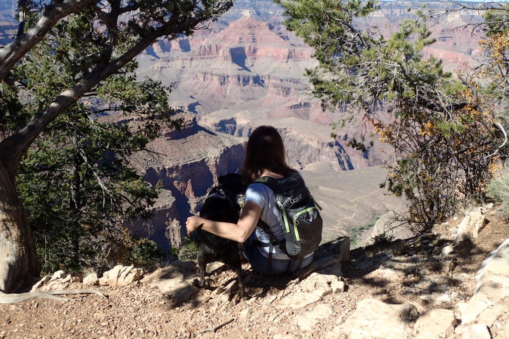
Back in the car, we pick up Abby and continue west. Our next stop is Arizona and the Grand Canyon. Grand Canyon National Park is one of my favorite places. You feel the serenity of the thousands and thousands of years that the wind and water have exposed. I could sit and stare at the view for hours. My past visits range from staying on the South Rim at the swanky El Tovar Hotel to hiking from the North Rim to the bottom to camp at Phantom Ranch. I am excited to be there with Abby and Kelly- both canyon virgins. This visit is brief, but sweet.
Kelly hikes down the iconic Bright Angel Trail for a few miles alone, as Abby isn’t allowed below the rim. Abby and I hike southeast along the rim trail until we no longer see people. We sit on the edge of the abyss, gazing at the beauty and taking in the peace of Mother Nature. Once reunited, Kelly, Abby, and I hike on a rim trail northwest of the Visitors Center.
As we head to Flagstaff from the Grand Canyon, I realize that geographically, we are headed home. The Grand Canyon is the westernmost point of this trip. With mixed emotions, at the Flagstaff airport, Kelly and I part with tears and hugs.


You May Also Like

Ave Abby
February 5, 2025
Nashville, McAfee Knob and HOME
January 20, 2018